


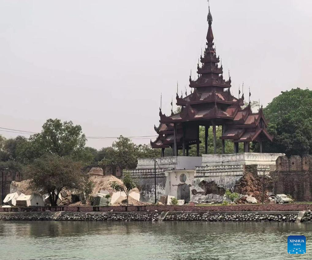
This photo taken on March 28, 2025 shows damage to the walled fort of Mandalay Palace after the earthquake in Mandalay, Myanmar. A 7.9-magnitude earthquake struck Myanmar at 2:20 p.m. Friday (Beijing Time), according to the China Earthquake Networks Center (CENC). The epicenter was monitored at 21.85 degrees north latitude and 95.95 degrees east longitude. The quake struck at a depth of 30 km, said a report issued by the CENC. (Xinhua)
BEIJING, March 28 (Xinhua) -- A 7.9-magnitude earthquake struck Myanmar at 2:20 p.m. Friday (Beijing Time), according to the China Earthquake Networks Center (CENC).
The epicenter was monitored at 21.85 degrees north latitude and 95.95 degrees east longitude. The quake struck at a depth of 30 km, said a report issued by the CENC. ■
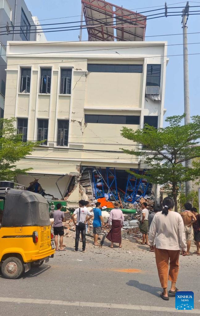
This photo taken on March 28, 2025 shows a damaged building after the earthquake in Mandalay, Myanmar.
A 7.9-magnitude earthquake struck Myanmar at 2:20 p.m. Friday (Beijing Time), according to the China Earthquake Networks Center (CENC).
The epicenter was monitored at 21.85 degrees north latitude and 95.95 degrees east longitude. The quake struck at a depth of 30 km, said a report issued by the CENC. (Xinhua)

This photo taken on March 28, 2025 shows damage to the walled fort of Mandalay Palace after the earthquake in Mandalay, Myanmar.
A 7.9-magnitude earthquake struck Myanmar at 2:20 p.m. Friday (Beijing Time), according to the China Earthquake Networks Center (CENC).
The epicenter was monitored at 21.85 degrees north latitude and 95.95 degrees east longitude. The quake struck at a depth of 30 km, said a report issued by the CENC. (Xinhua)

This photo taken on March 28, 2025 shows a damaged building after the earthquake in Mandalay, Myanmar.
The earthquake, with a magnitude of 7.7, jolted 16 km NNW of Sagaing, Myanmar earlier in the day, the U.S. Geological Survey said.
The epicenter, with a depth of 10.0 km, was initially determined to be at 22.01 degrees north latitude and 95.92 degrees east longitude. (Xinhua)

(250328) -- YANGON, March 28, 2025 (Xinhua) -- This photo taken with a mobile phone shows people fleeing to the streets after an earthquake in Yangon, Myanmar, March 28, 2025.
The earthquake, with a magnitude of 7.7, jolted 16 km NNW of Sagaing, Myanmar earlier in the day, the U.S. Geological Survey said.
The epicenter, with a depth of 10.0 km, was initially determined to be at 22.01 degrees north latitude and 95.92 degrees east longitude. (Xinhua)


