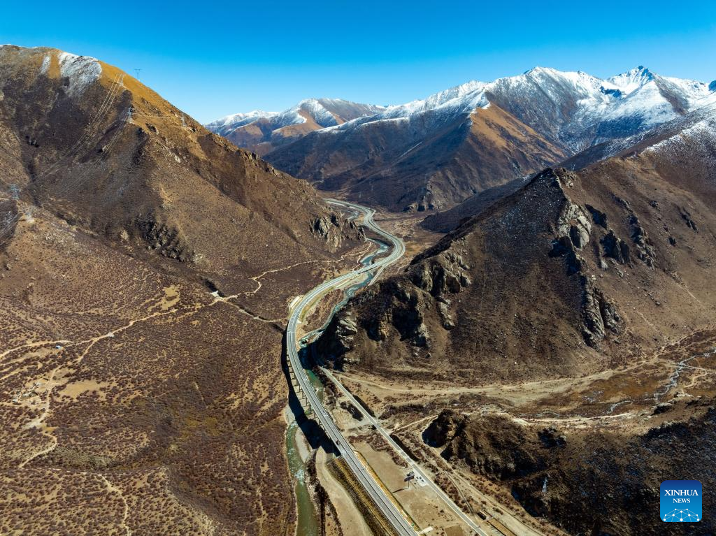
An aerial drone photo taken on Nov. 9, 2024 shows the Lhasa-Nyingchi expressway (L) and National Highway 318 (coded G318). The Sichuan-Xizang highway connecting southwest China's Sichuan Province and Xizang Autonomous Region serves as the artery linking the plateau region and the country's inland areas. It shares part of the route with two National Highways, G318 and G317, and is known for steep mountains and rugged terrain through which it winds. (Xinhua/Shen Bohan)
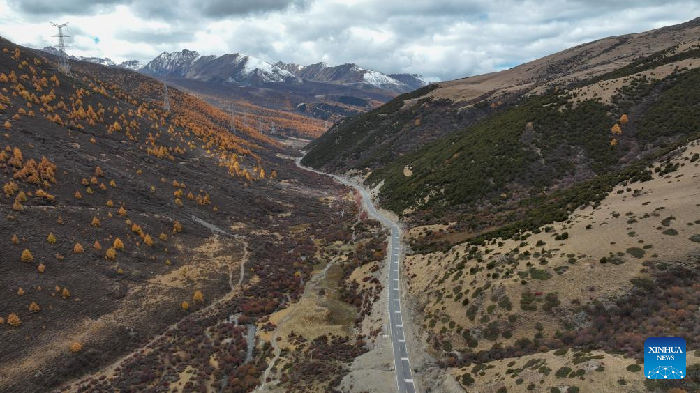
An aerial drone photo taken on Nov. 1, 2024 shows the National Highway 318 (coded G318) in Ganzi Tibetan Autonomous Prefecture, southwest China's Sichuan Province. The Sichuan-Xizang highway connecting southwest China's Sichuan Province and Xizang Autonomous Region serves as the artery linking the plateau region and the country's inland areas. It shares part of the route with two National Highways, G318 and G317, and is known for steep mountains and rugged terrain through which it winds. (Xinhua/Xu Bingjie)
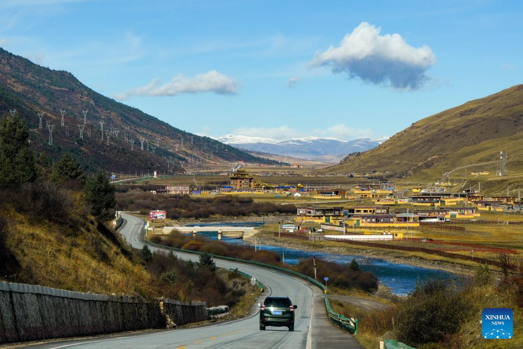
A vehicle moves on the National Highway 317 (coded G317) in Ganzi Tibetan Autonomous Prefecture, southwest China's Sichuan Province, Nov. 1, 2024. The Sichuan-Xizang highway connecting southwest China's Sichuan Province and Xizang Autonomous Region serves as the artery linking the plateau region and the country's inland areas. It shares part of the route with two National Highways, G318 and G317, and is known for steep mountains and rugged terrain through which it winds. (Xinhua/Shen Bohan)

A vehicle drives on the National Highway 317 (coded G317) in Ganzi Tibetan Autonomous Prefecture, southwest China's Sichuan Province, Oct. 28, 2024. The Sichuan-Xizang highway connecting southwest China's Sichuan Province and Xizang Autonomous Region serves as the artery linking the plateau region and the country's inland areas. It shares part of the route with two National Highways, G318 and G317, and is known for steep mountains and rugged terrain through which it winds. (Xinhua/Shen Bohan)
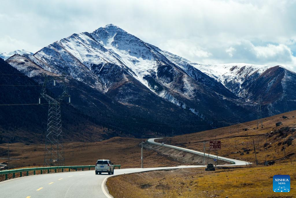
A vehicle moves on the National Highway 317 (coded G317) in Ganzi Tibetan Autonomous Prefecture, southwest China's Sichuan Province, Nov. 1, 2024. The Sichuan-Xizang highway connecting southwest China's Sichuan Province and Xizang Autonomous Region serves as the artery linking the plateau region and the country's inland areas. It shares part of the route with two National Highways, G318 and G317, and is known for steep mountains and rugged terrain through which it winds. (Xinhua/Shen Bohan)
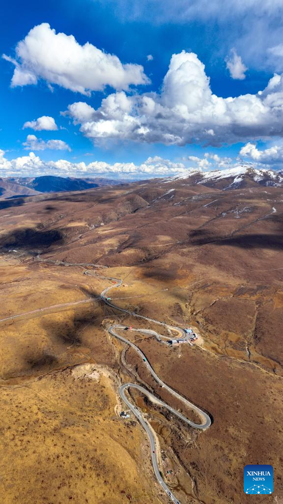
An aerial drone photo taken on Oct. 31, 2024 shows the National Highway 317 (coded G317) in Ganzi Tibetan Autonomous Prefecture, southwest China's Sichuan Province. The Sichuan-Xizang highway connecting southwest China's Sichuan Province and Xizang Autonomous Region serves as the artery linking the plateau region and the country's inland areas. It shares part of the route with two National Highways, G318 and G317, and is known for steep mountains and rugged terrain through which it winds. (Xinhua/Shen Bohan)

An aerial drone photo taken on Nov. 6, 2024 shows vehicles waiting on the National Highway 318 (coded G318) in Zongang, southwest China's Xizang Autonomous Region. The Sichuan-Xizang highway connecting southwest China's Sichuan Province and Xizang Autonomous Region serves as the artery linking the plateau region and the country's inland areas. It shares part of the route with two National Highways, G318 and G317, and is known for steep mountains and rugged terrain through which it winds. (Xinhua/Shen Bohan)
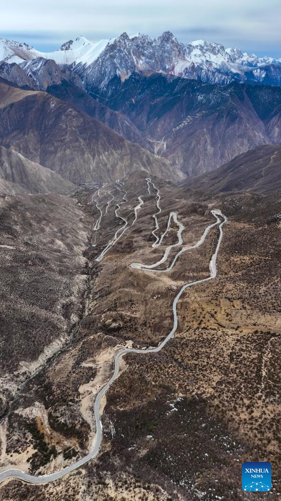
An aerial drone photo taken on Nov. 7, 2024 shows the National Highway 318 (coded G318) in Baxoi, Qamdo, southwest China's Xizang Autonomous Region. The Sichuan-Xizang highway connecting southwest China's Sichuan Province and Xizang Autonomous Region serves as the artery linking the plateau region and the country's inland areas. It shares part of the route with two National Highways, G318 and G317, and is known for steep mountains and rugged terrain through which it winds. (Xinhua/Shen Bohan)
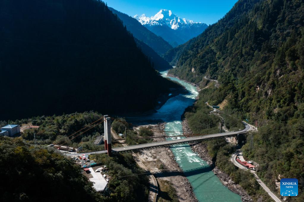
An aerial drone photo taken on Nov. 8, 2024 shows a grand bridge of the National Highway 318 (coded G318) in Bomi of Nyingchi, southwest China's Xizang Autonomous Region. The Sichuan-Xizang highway connecting southwest China's Sichuan Province and Xizang Autonomous Region serves as the artery linking the plateau region and the country's inland areas. It shares part of the route with two National Highways, G318 and G317, and is known for steep mountains and rugged terrain through which it winds. (Xinhua/Shen Bohan)
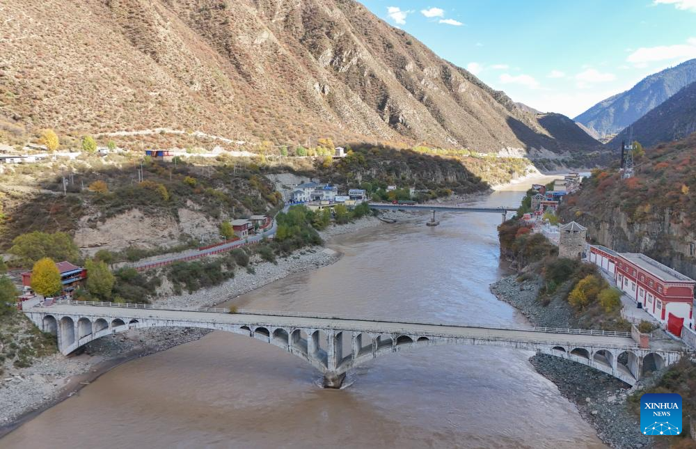
An aerial drone photo taken on Nov. 2, 2024 shows two bridges of the National Highway 317 (coded G317) linking southwest China's Sichuan Province and Xizang Autonomous Region. The Sichuan-Xizang highway connecting southwest China's Sichuan Province and Xizang Autonomous Region serves as the artery linking the plateau region and the country's inland areas. It shares part of the route with two National Highways, G318 and G317, and is known for steep mountains and rugged terrain through which it winds. (Xinhua/Wang Xi)
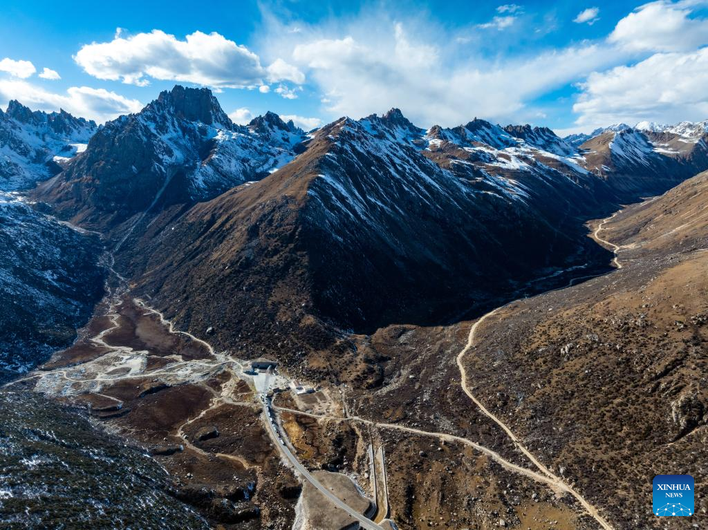
An aerial drone photo taken on Nov. 1, 2024 shows the National Highway 317 (coded G317) in Ganzi Tibetan Autonomous Prefecture, southwest China's Sichuan Province. The Sichuan-Xizang highway connecting southwest China's Sichuan Province and Xizang Autonomous Region serves as the artery linking the plateau region and the country's inland areas. It shares part of the route with two National Highways, G318 and G317, and is known for steep mountains and rugged terrain through which it winds. (Xinhua/Shen Bohan)
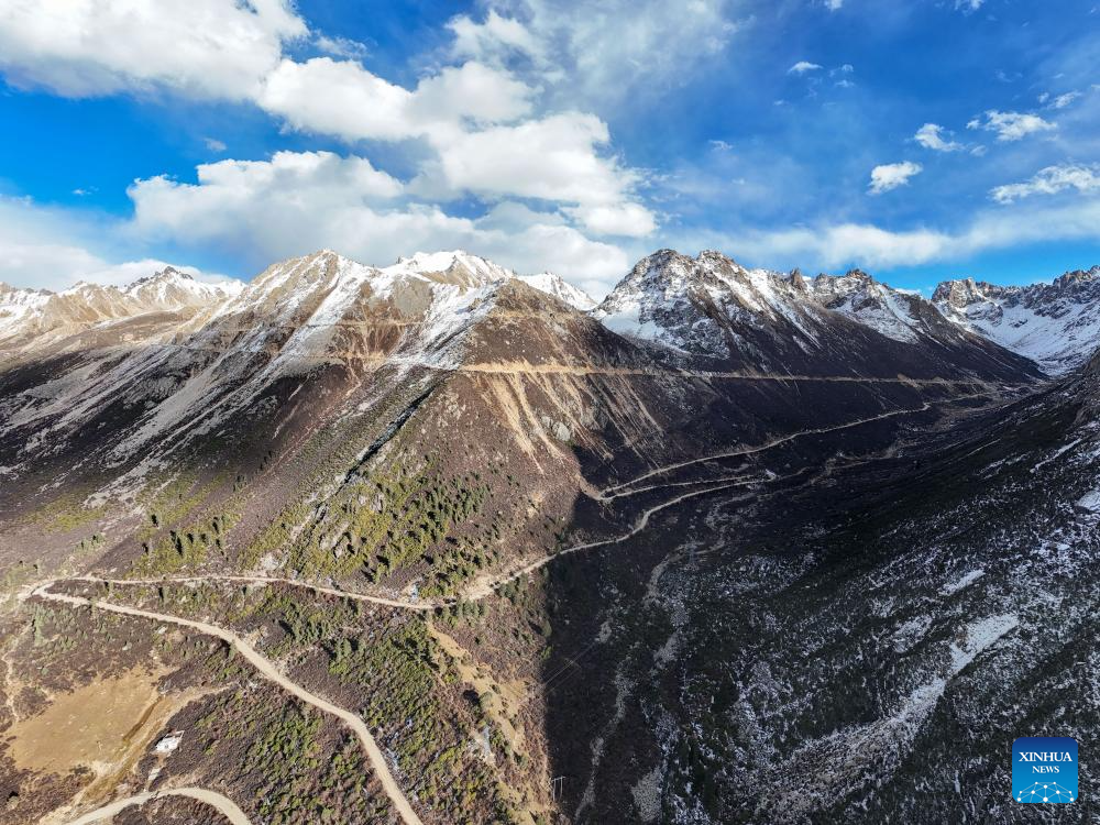
An aerial drone photo taken on Nov. 1, 2024 shows an old section of the National Highway 317 (coded G317) in Ganzi Tibetan Autonomous Prefecture, southwest China's Sichuan Province. The Sichuan-Xizang highway connecting southwest China's Sichuan Province and Xizang Autonomous Region serves as the artery linking the plateau region and the country's inland areas. It shares part of the route with two National Highways, G318 and G317, and is known for steep mountains and rugged terrain through which it winds. (Xinhua/Wang Xi)
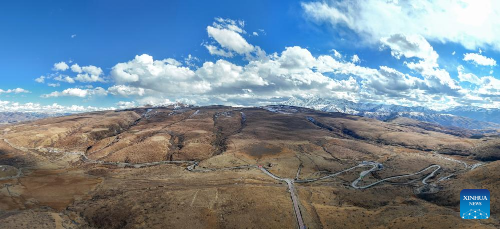
An aerial drone photo taken on Oct. 31, 2024 shows the National Highway 317 (coded G317) in Ganzi Tibetan Autonomous Prefecture, southwest China's Sichuan Province. The Sichuan-Xizang highway connecting southwest China's Sichuan Province and Xizang Autonomous Region serves as the artery linking the plateau region and the country's inland areas. It shares part of the route with two National Highways, G318 and G317, and is known for steep mountains and rugged terrain through which it winds. (Xinhua/Wang Xi)
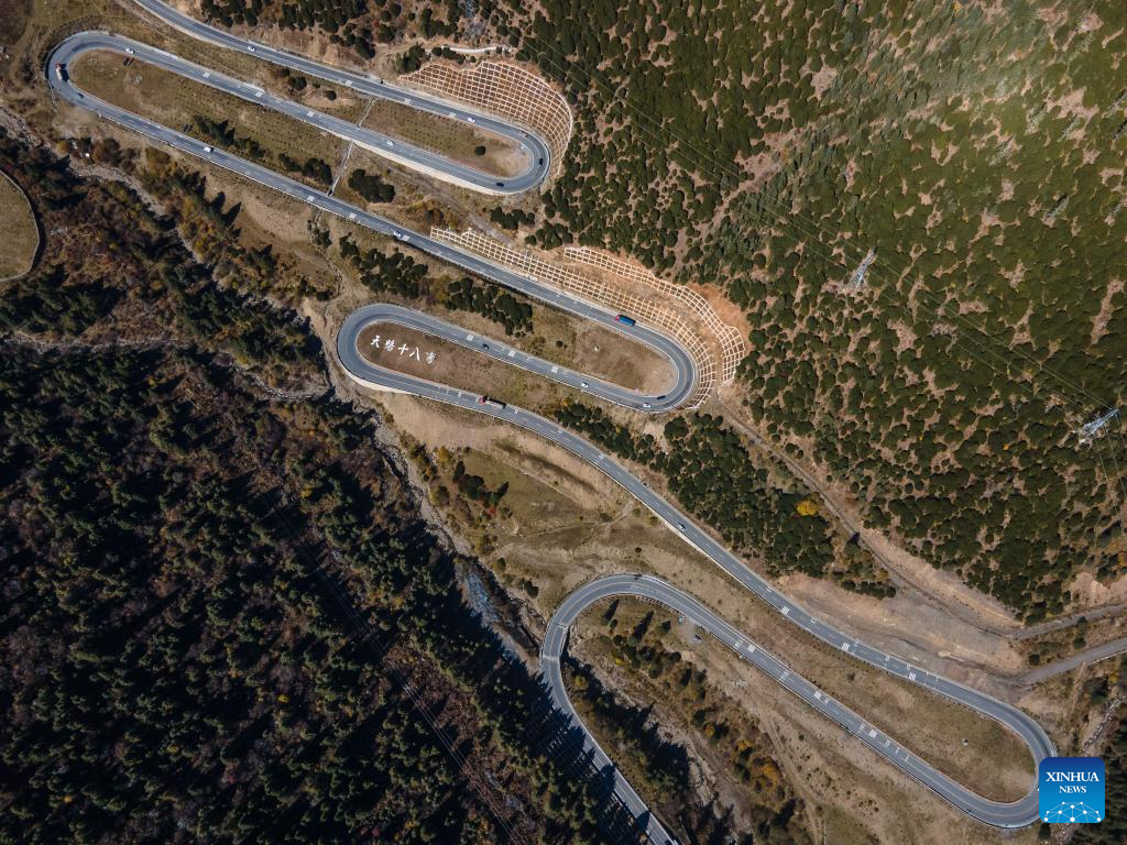
An aerial drone photo taken on Oct. 29, 2024 shows the National Highway 318 (coded G318) in Ganzi Tibetan Autonomous Prefecture, southwest China's Sichuan Province. The Sichuan-Xizang highway connecting southwest China's Sichuan Province and Xizang Autonomous Region serves as the artery linking the plateau region and the country's inland areas. It shares part of the route with two National Highways, G318 and G317, and is known for steep mountains and rugged terrain through which it winds. (Xinhua/Chu Jiayin)
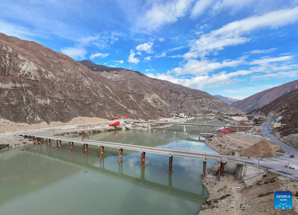
An aerial drone photo taken on Nov. 6, 2024 in Ganzi Tibetan Autonomous Prefecture, southwest China's Sichuan Province, shows bridges across the Jinsha River between Sichuan and Xizang. The Sichuan-Xizang highway connecting southwest China's Sichuan Province and Xizang Autonomous Region serves as the artery linking the plateau region and the country's inland areas. It shares part of the route with two National Highways, G318 and G317, and is known for steep mountains and rugged terrain through which it winds. (Xinhua/Wang Xi)
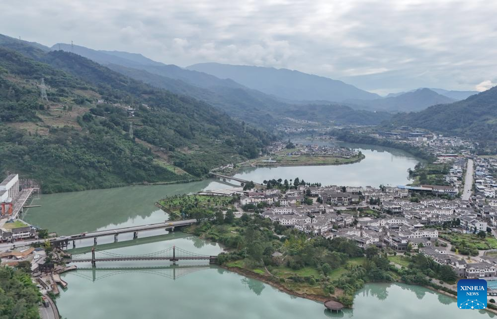
An aerial drone photo taken on Oct. 27, 2024 shows the National Highway 318 (coded G318) in Lushan County of Ya'an, southwest China's Sichuan Province. The Sichuan-Xizang highway connecting southwest China's Sichuan Province and Xizang Autonomous Region serves as the artery linking the plateau region and the country's inland areas. It shares part of the route with two National Highways, G318 and G317, and is known for steep mountains and rugged terrain through which it winds. (Xinhua/Wang Xi)

An aerial drone photo taken on Nov. 7, 2024 shows the National Highway 318 (coded G318) in Baxoi, Qamdo, southwest China's Xizang Autonomous Region. The Sichuan-Xizang highway connecting southwest China's Sichuan Province and Xizang Autonomous Region serves as the artery linking the plateau region and the country's inland areas. It shares part of the route with two National Highways, G318 and G317, and is known for steep mountains and rugged terrain through which it winds. (Xinhua/Chu Jiayin)
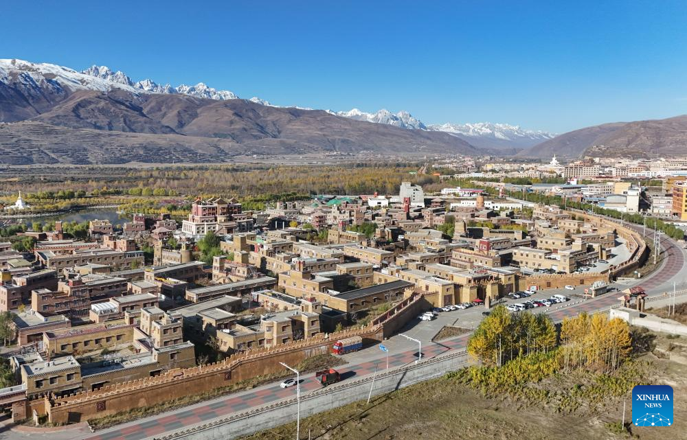
An aerial drone photo taken on Oct. 29, 2024 shows the King Gesar city scenic area beside the National Highway 317 (coded G317) in Ganzi Tibetan Autonomous Prefecture, southwest China's Sichuan Province. The Sichuan-Xizang highway connecting southwest China's Sichuan Province and Xizang Autonomous Region serves as the artery linking the plateau region and the country's inland areas. It shares part of the route with two National Highways, G318 and G317, and is known for steep mountains and rugged terrain through which it winds. (Xinhua/Wang Xi)
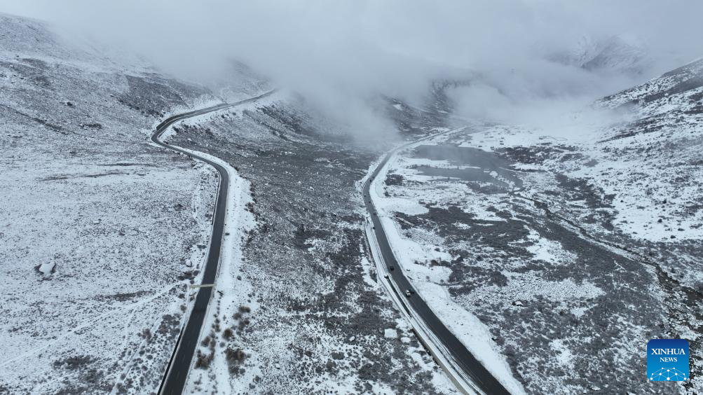
An aerial drone photo taken on Nov. 4, 2024 shows the National Highway 318 (coded G318) in Ganzi Tibetan Autonomous Prefecture, southwest China's Sichuan Province. The Sichuan-Xizang highway connecting southwest China's Sichuan Province and Xizang Autonomous Region serves as the artery linking the plateau region and the country's inland areas. It shares part of the route with two National Highways, G318 and G317, and is known for steep mountains and rugged terrain through which it winds. (Xinhua/Xu Bingjie)


